Watershed Language v1: Manual Translation
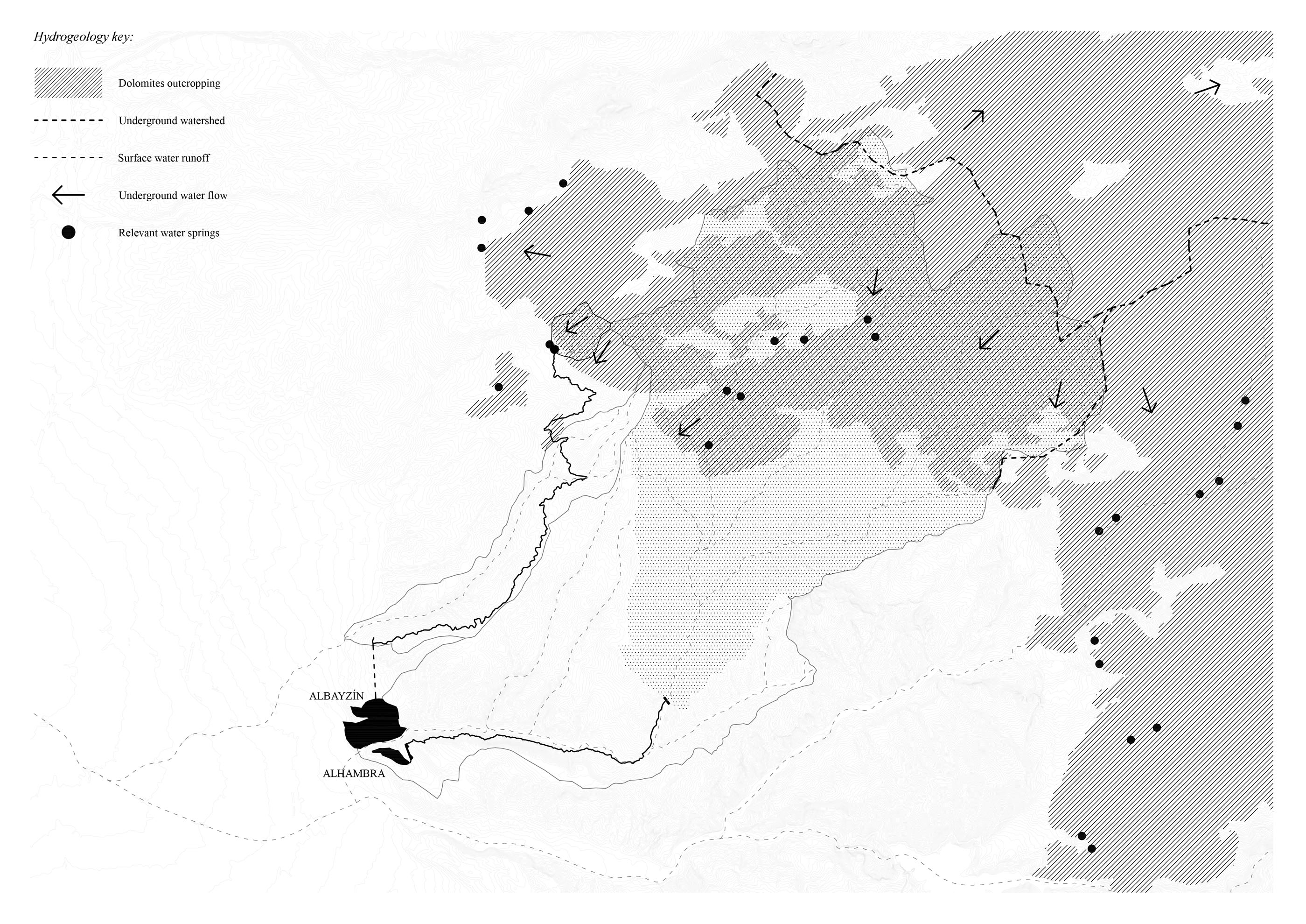
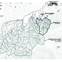
The watershed is a boundary that defines an area where all the water that falls there flows to the same point. The limits of this boundary are traced by following a series of ridgelines that separate different drainage areas, where the water ends up flowing through a same runoff line.
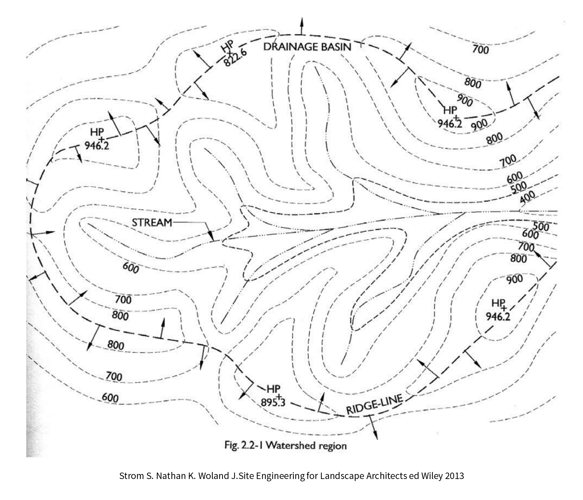
Different watersheds exist at different scales, and one watershed can exist inside another larger scale watershed. The main watershed is determined by the scale that you are analysing, and subwatersheds can be defined within that boundary by tracing secondary ridgelines. The runoff lines show the path of water in a watershed. These lines are always drawn perpendicular to the contour lines.
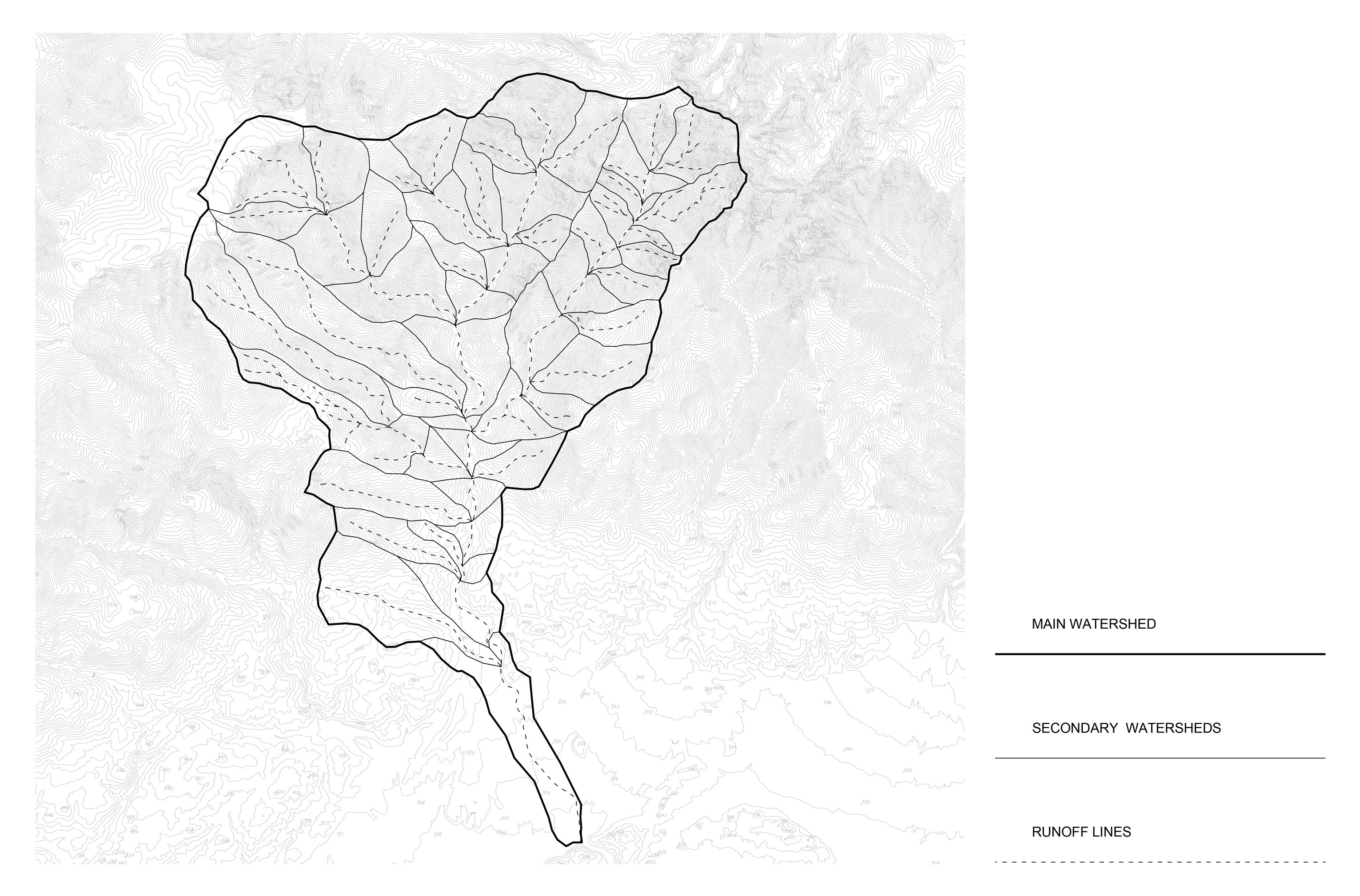
Main Watershed: Determined by the ridgeline of the largest basin.
Secondary Watersheds: Determined by the ridgelines of smaller catchments in the basin.
Runoff Lines: The linear connection of the lowest point of each contour line in each catchment.
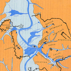
The watersheds reveal how topography creates relationships between disparate locations: each place is affected by what happens further up the watershed, and likewise, our actions in a single location have an impact on everything downstream. For that reason, watersheds are a crucial tool in the political, economic and environmental management of the territory.
The manual drawing of the watersheds is not only a first step for the definition of this language but also an important tool of approaching the territorial analysis through reading the topography. It is important to note that the watersheds drawing must be supported by other large-scale analysis basis as, for instance, climate and geology, as these two factors can completely change the impression of the water circulation system that we get at first with the watersheds.